Monday, January 30, 2012

It's (not) Only Natural

Upon hearing or reading the words "National Park Service" it's only natural to think of great American places like Yellowstone and Yosemite, the Grand Canyon and the Great Smoky Mountains.  These are, after all, the crown jewels of America's national park system, places that attract the lion's share of the more than 280 million people who visited the National Park System in 2010, places whose iconic features like Half Dome and Old Faithful grace oodles of calendars every year, places celebrated by Ken Burns in America's Best Idea.

But in terms of numbers (if not acres) the National Park System's National Battlefields (11), Memorials (28), Historic Sites (79) and Parks (42) outnumber its National Parks (58) and Monuments (74).  From the Gettysburg National Military Park and Big Hole National Battlefield to the Eugene O'Neill, Dwight D Eisenhower and Brown vs. Board of Education National Historic Sites, the NPS is as focused on preserving and celebrating America's remarkable history as its incomparable natural treasures.

So while one might not necessarily think of Western Pennsylvania and the National Park Service in the same breath, there are no less than half a dozen NPS sites in the western portion of the Keystone State, including the most recent addition -- the Flight 93 National Memorial near Shanksville.  In fact, the Flight 93 National Memorial is part of a diverse quartet of NPS sites scattered around the Laurel Highlands that includes the Allegheny Portage Railroad National Historic Site, the Johnstown Flood National Memorial and the Fort Necessity National Battlefield . . . in other words, two national tragedies, a seminal battle in the birth of the nation and one of the great technological marvels of the early 19th century are all commemorated and preserved by the NPS within an hour or two of Pittsburgh. 

In any case, as one who counts his visits to many of America’s great National Parks among the most enduring memories of his formative years, I’ve long harbored what (with each passing year) seemed increasingly to be a mere fantasy of someday working for the NPS.   Well, I’m delighted to say it’s no longer a mere fantasy.  No, I haven’t traded-in my iRacing, Penguins and Steelers ball caps for an official Smokey the Bear lid.  But I am now the proud possessor of an NPS Volunteer ball cap . . . and sweater . . . and polo shirt.

Last autumn, a trip that began as a hiking/backpacking adventure in the Colorado Rockies got snowed-out and I beat a retreat to the dry warmth of Canyonlands National Park.  There, while on a day hike to the confluence of the Green and Colorado Rivers, I fell-in with a seasonal NPS employee who explained the various levels/gradations of work within the system and urged me to explore volunteer work as a first step.  When I returned home I cast around not only to the local NPS sites but a couple of State Parks and was delighted to be welcomed to the Allegheny Portage Railroad (APR) National Historic Site by Gregory Zaborowski, the park’s gregarious head of volunteer programs.

I quickly received a primer on the APR, to wit, it was the lynchpin in a series of canals stretching from Philadelphia to Pittsburgh in the early to mid-1800s.  The APR featured ten steam engine-powered inclines used to haul the cargo and passengers up (and down!) the 1400’ heights of the Allegheny Mountains between Johnstown and Hollidaysburg.  In the its early years of operation, passengers and cargo were off-loaded from canal barges at each end of the portage, transferred to rail cars, hauled over the mountains and re-loaded onto canal barges on the other side.  Later, a system was devised where the barges themselves were loaded onto what amounted to flat-bed rail cars, eliminating the time-consuming off-loading/loading process.  Another improvement came when the ropes used to haul the cars on the inclines were replaced by a new fangled system of wire cables developed by a fellow named James Roebling.  In fact, the APR was the first large scale demonstration of the efficacy of Roebling’s cables, ultimately paving the way for their use in his Brooklyn Bridge.  Another first was the 900' long Staple Bend Tunnel, the first railway tunnel ever built in the United States.

It may sound like a helluva lot of work and effort to those of us used to driving between Pittsburgh and Philadelphia in 5 hours – or flying between the two ends of the state in less than an hour.  But in its day the Allegheny Portage Railroad cut the time it took to travel between the two cities from 26 to five days.  While the APR represented an immense advance in transportation, that day would prove relatively short. Improvements in steam engines ultimately enabled the railroads to overcome the Allegheny Mountains – with the help of the world-renowned Horesehoe Curve, itself just a mile or two away from the Allegheny Portage Railroad National Historic Site.

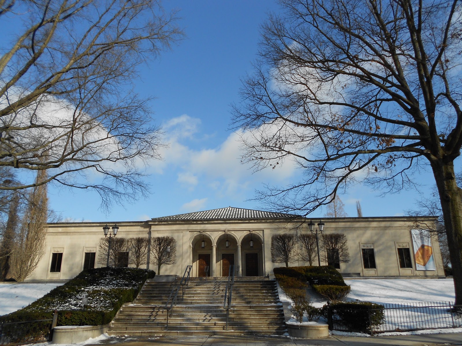
The bad news is that Gregory and I didn’t really connect until just a few weeks before Christmas or, in other words, after the Allegheny Portage Railroad National Historic Park goes into virtual hibernation for the winter.  Not that the employees go to sleep for three or four months.  The visitor center is open as are all the exhibits in the modestly sized main site, including the visitor center, Engine House #6 and the adjacent Lemon House Tavern where travelers including Charles Dickens, Jenny Lin and Harriet Beecher Stowe may have paused for refreshments (liquid and otherwise) while traversing the Alleghenies on the APR.  But with winds and snow whipping around the top of the Alleghenies, visitors are few and far between in the winter months.


The good news is that Gregory was able to give me a personal tour of the site and its environs, including the Staple Bend Tunnel located near Johnstown and now the highlight of a two mile hiking/biking trail.  Meanwhile, back towards Hollidaysburg stands the APR’s elegant Skew Arch bridge and another, more rugged, trail connecting Inclines 6 to 10.

I also learned the APR is heavy into historical re-enactments featuring employees and volunteers who dress in period costumes and perform tasks associated with the railroad including stone cutting, log hewing, rope making and blacksmithing.  As well, there are occasional “ghost tours” of the Staple Bend Tunnel and the Evening at the Summit series of musical concerts and presentations and concerts in the park’s amphitheater.  

Volunteers are encouraged to participate in any or all of the activities, be it dressing in period costume to hew a log or conduct tours of Lemon House, or just spending afternoons hiking or biking the trails and serving as a semi-official NPS presence in some of the APR’s far flung reaches.

Who knows how much (or how little) I’ll be able to do.  But I have a couple of months to bone up on the history of the Allegheny Portage Railroad . . . not to mention the Johnstown Flood.  For the Allegheny Portage Railroad National Historic Site and Johnstown Flood National Memorial are “sister” parks, staffed largely by the same NPS employees and volunteers.

So in the coming months, I’ll share some of my NPS volunteering experience with you.  It gives me yet another reason to look forward to spring!

Monday, January 23, 2012

Currier and Ives Meet the Kings and the Browns


It'll nearly be like a picture print
By Currier and Ives . . .

OK, the holiday season is rapidly receding in the rear view mirror, and hearing Nat King Cole croon “Sleigh Ride” for the umpteenth time may not be your cup of tea this late into January.

But it finally snowed in Pittsburgh for real on Friday, thus Saturday morning dawned on what, to my mind, is the closest thing to “a picture print by Currier and Ives” you’re likely to see anywhere – sled riding at the King Estate.

The King Estate (technically “Baywood”) is an elegant Second Empire mansion built by glass magnate Alexander King on several acres of land in the Highland Park neighborhood in 1880.   After wisely marrying into the Mellon family, King’s heirs donated Baywood and its grounds to the City of Pittsburgh in 1954 under the proviso that the mansion be torn down if the city was unable to properly maintain it. 

For the next forty years, as the city under-utilized Baywood to house arts and crafts programs for children and pre-teens, the once glorious building steadily deteriorated as a white elephant on the parks and recreation budget.  Sooner or later, the King family’s edict would surely have been enforced . . . until a local doctor and his pharmacist wife (Frank and Maura Brown) overcame fierce opposition from various neighborhood and civic groups to buy the joint in 1994 for the princely sum of $150,000.


While the Browns set about restoring Baywood itself to its former glory, the surrounding grounds remained in the city’s hands as a small but delightfully engaging park.  The principle geographical feature of The King estate is a “bowl” of land between Baywood and nearby Negley Avenue.  A semi-circular depression dipping down perhaps 50’ below street level (Nature’s perfect ¾ pipe?), it’s almost ideal for sled riding when the snow flies.  “Almost” is the operative word as, with sledders of all ages and sizes careening down its short but steep slopes from (nearly) all directions, it can resemble a near-circular firing squad on busy winter days.

And make no mistake, Saturday was a very busy winter day, with hundreds of kids (and the occasional Mom or Dad) sliding down the Bowl on sleds, inner-tubes and “saucers” as well as makeshift devices ranging from cardboard boxes to the odd cafeteria tray.  The sides of the Bowl were soon packed hard and, after a night of sub-freezing temperatures, Sunday with its slopes hardened to glacial consistency – making for even more thrilling descents.

Those who dared turn their back on the sledders, could follow the bottom of the Bowl where it funnels into a little glen of maples, ashes and hemlocks.  A trail leading into the trees showed evidence that several parents had, in all likelihood, towed their sled-sitting kids to a tantalizingly brief winter woodland experience beneath the gaze of Baywood and its outlying crenelated towers.  Make that crenelated tower (singular), as the battlements that once stood atop one of the towers now lie on their side near the bottom of the glen – sparking this visitor to muse upon the lives of Alexander King’s grandchildren who must have grown-up with, quite literally, a play castle in their backyard.

Deeper into the woods stands a trestle on the miniature railroad line running through the Pittsburgh Children’s Zoo and, buried under the snow somewhere is one of those urban mysteries: the rusting frame and parts of a drive-train from a mid-century Buick that someone, somehow contrived to drive into these woods.  How did it get there?  Who knows?  How do I know it’s a mid-century Buick?  Well, for openers the stout trees growing in the engine bay couldn’t be less than 40 years old . . . or so it seemed to me that last time I actually saw the old heap.  That would have been last summer, long before the snow flew and long before I couldn’t begin to find the car on my trip through the King Estate’s acre or so woods last weekend.

No matter, the old Buick will surely still be there the next time I tramp through the woods near Baywood.  Come to think of it, so will Baywood itself . . . thanks to the Kings of course, but mainly to the Browns and a city that recognized it was better to sell a magnificent white elephant to caring folks who could restore it to its former glory than simply expunging it from the books via the wrecking ball.

Monday, January 16, 2012

Restoration 'R Us


Were I a better shooter or had I a few thousand bucks worth of cameras and lenses, this installment would lead-off with a superb photo of Pittsburgh’s Nine Mile Run flowing below the Parkway East (aka I-376) and a sign beside the new houses high on the hill overlooking it all reading “HOMES AVAILABLE.”  

But I'm not and I don't, so I'll have to explain it mainly in words . . .

From its sources in the near eastern suburbs of Pittsburgh, Nine Mile Run courses down through the city's Frick Park en route to the Monongahela River.  It empties into the river across from Homestead’s massive Waterfront shopping complex – formerly the site of Andrew Carnegie’s (later, U.S. Steel’s) gargantuan steel mill, scene of a particularly bloody chapter in the American labor movement – some nine miles above “The Point,” where “The Mon” joins the Allegheny to form the Ohio River.

For the best part of a century, Nine Mile Run was a poster-child for just about every environmental insult Man could inflict upon a water-way: a depository not just for the raw sewage flowing from nearby neighborhoods like Squirrel Hill, Regent Square, Duck Hollow, Edgewood, Wilkinsburg and Swissvale in times of heavy rain, but for the caustic runoff from an estimated 200 million tons of slag from the Carnegie, U.S. Steel and Jones & Laughlin mills dumped nearby, not to mention the usual urban notsam and flotsam of old automobile tires, purloined shopping carts, “disposable” diapers and the like.

A little over a decade ago, the City of Pittsburgh, the Army Corps of Engineers, Carnegie-Mellon University and the Nine Mile Run Watershed Association got together and launched a major initiative to clean-up Nine Mile Run.  The work included reconfiguring stream channels and building boardwalks overlooking dozens of acres of reconstructed wetland, along with enhancing native wildlife habitats and planting native trees, shrubs and wildflowers.  When completed in 2006, the Nine Mile Run project was the largest urban stream restoration in the United States.

Ironically, the restoration project might never have happened but for the slag heaps that did so much to taint the waters draining into Nine Mile Run.  In its ongoing efforts to reinvent itself following the steel industry’s collapse in the 1980s, the city of Pittsburgh targeted those man-made mountains as the site of a new, upscale housing project, aka Summerset.  Understanding it would be problematic to get potential buyers to part with their money for houses overlooking what often amounted to an open-air urban latrine, the City joined forces with the Corps of Engineers, CMU and the NMRWA to restore the waterway and wetlands.  Ten years and $7.7M later, the project resulted in the renewal of what no less than Frederic Law Olmstead, Jr. once opined was “perhaps the most striking opportunity noted for a large park” in America.

But there’s a deeper irony at work here.  After all, the nucleus of Frick Park consists of lands donated to the City of Pittsburgh by Henry Clay Frick, the man whose company provided the coke used by Andrew Carnegie’s steel mills . . . whose slag did so much to poison the waters of the park bearing Frick’s name.

Frick’s stately mansion – Clayton – is a stone’s throw from the northern edge of the 151 acre parcel of woodlands he bequeathed to the city in 1919.  Subsequently, Frick’s daughter Helen donated additional acreage for the park and, with the recent addition of 106 acres in lower Nine Mile Run adjoining Summerset, Frick Park now totals more than 560 acres, making it the largest of Pittsburgh’s parks. 

With all due respect to the lions, tigers and bears in the zoo at Highland Park, Frick Park is Pittsburgh’s wildest space.  More than 100 species of birds have been identified in the park, and reliable (or at least believable) sitings of bears are not uncommon.  Apart from small sections in Squirrel Hill, Point Breeze and Regent Square, the majority of the park consists of wooded hillsides and ravines running down to the relatively level “flood plains” of Nine Mile Run and Fern Hollow.  As such, accessing the bulk of the park requires committing to a hike or bicycle ride down (and later, up) steep hillside trails.  What’s more, Frick Park is rather linear in nature, stretching the best part of three miles from the John Russell Pope-designed Gatehouse on Reynolds Street to where Nine Mile Run discharges into the Monongahela River. 

Like most any urban park, Frick Park has its civilized side.  Not far from the Gatehouse and Clayton stands the Frick Art Museum, built at the behest of Helen Clay Frick, opened to the public in 1970 and currently winding-down a major exhibition of FabergĂ© “objects.”  And just down the street from “The Frick” stand the only public lawn bowling greens in the Commonwealth of Pennsylvania.  The Regent Square side of the park boasts clay tennis courts, baseball fields and a playground while, at Squirrel Hill’s entrances, there’s another playground as well as the Frick Park Nature center, currently being restored in the wake of a devastating fire in 2002.

Of course, as the Nine Mile Run project attests, restoration projects are at the very core of Frick Park . . . much like a Pittsburgh that is continually restoring, reinventing and even reimagining itself.

Monday, January 9, 2012

Win-Win


With real, live lions, tigers ‘n bears living yards away from picnickers, joggers, beach volleyball players and the city’s only dedicated bicycle track, Highland Park is surely the most diverse of Pittsburgh’s great parks. 


Those lions, tigers and bears reside in the Pittsburgh Zoo and PPG Aquarium, tucked away in the Park’s northwest corner along with a delightful zoological mosaic lining the road known as One Wild Place.  The picnickers can be found at any of a score of open air shelters dotted around the 380 acre green space that also includes a faux beach complete with volleyball courts adjacent to a public swimming pool and a pond rather grandiosely named “Lake Carnegie.”  Meanwhile, over and down a precipitous hillside -- and thus separate from the main body of the park -- sits the Bud Harris Cycling Track, a paved half mile oval with banked turns.

But as most any Pittsburgher can attest, the heart of Highland Park is The Reservoir, a man-made, kidney-shaped bowl atop a height of land named for Edward Bigelow (father of the city’s park system) that’s provided drinking water to the city since 1879.  Actually, Highland Park boasts two reservoirs, but Reservoir #2 is locked behind a chain link fence on a knoll above the zoo parking lot, decidedly off limits to the public.  Reservoir #1, on the other hand, has been a magnet for generations of joggers and walkers who circulate its 7/10 mile perimeter and, in the late spring, summer and early fall, enjoy the breezes drifting across its waters against a backdrop stretching from the glass and steel Parklane apartment tower to the middle class houses of Morningside and Stanton Heights across to the rocky bluffs on the far side of the Allegheny River.

One would be hard-pressed to find a resident of Pittsburgh’s eastern neighborhoods who hasn’t made his or her share of laps around The Reservoir; or spent an hour or two people-watching or conversing with friends, neighbors and former strangers while perched on one of the benches dotting the asphalt path around its perimeter.

This central component of life in the East End was at risk in the 1990s when the EPA concluded it wasn’t such a great idea for city residents to be drinking water from a man-made lake exposed to the witches-brew of airborne toxins and carcinogens that continued falling to earth even after Pittsburgh cleaned-up its infamously polluted skies in the 1950s and ‘60s, and the sources of much of that pollution vanished (along with the steel industry) in the ‘80s.  The government’s proposed solution was inelegant at best, hideous at worst:  a cap/roof that would have transformed the beloved Reservoir into the aesthetic equivalent of a parking lot.

Years of legal wrangling ultimately produced a remarkable victory for common sense when a host of government agencies, environmental organizations and community groups agreed on an alternative that not only alleviated the need for that monstrous roof, but resulted in a couple of added attractions to Highland Park.  The plan featured a new microfiltration plant (housed in a building designed in architectural harmony with the Park’s existing structures) along with a “water feature” - a “Babbling Brook” that naturally de-chlorinates and aerates water from The Reservoir as it tumbles down the hill to Lake Carnegie.

In the process, the Babbling Brook crosses one of the least-utilized features of Highland Park – its network of woodland trails.   While the walk around The Reservoir draws people by the hundreds daily, I rarely encounter anyone while hiking the gently meandering trails encircling Mt. Bigelow.  As with most any urban park, the paths of Highland Park hardly offer a sense of remote solitude akin to the Appalachian or Pacific Crest Trails.  At any time of day the noise of automobile traffic rushing along nearby Allegheny River Boulevard and the freight trains lumbering along both sides of the river is with you.  On summer days, sounds of picnickers and their radios drift among the trees; on occasion, the roar of lions and cries of peacocks penetrate the woodsy calm as well.

Still, the hiker able to compartmentalize the disparate elements of Highland Park’s soundtrack can pause on the new footbridge spanning the Babbling Brook, focus on the patter of The Reservoir’s water “aerating” on its merry way down to Lake Carnegie and, for a few moments, imagine he is standing at the headwaters of the Shenandoah or Snoqualmie Rivers . . . and give thanks that, every once in a great while, what initially seems to be the clash of regulatory agencies, environmental groups and civic organizations produces a win-win outcome for everyone.